On all four images, East is at top. The reason for this orientation
is that they were all taken by Lunar Orbiter V and the fifth mission was
conducted in a nearly polar orbit. The stereoscopic impression conveyed
by these alaglyphs is an exaggerated one.
 TOBIAS
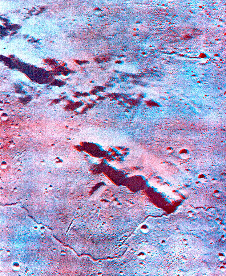
MAYER DOME Section 19, Brayley lo5m164
TOBIAS
MAYER DOME Section 19, Brayley lo5m164
Stereoscopic view of an area sw of the crater Tobias Mayer in Oceanus
Procellarum. The highland ridge in the middle portion of the anaglyph is
about 35 km long and 2 km high. A smooth mare dome abuts the western flank
of the ridge. The dome is about 20 km in diameter and exhibits an elongate
summit crater, about 5 km long. A sinuous rille meanders across the lower
part of the photograph, detouring around the base of the dome. Note the
presence of several crater chains in the lower half, and a large highland
mass at upper left.
 SCHROTERS
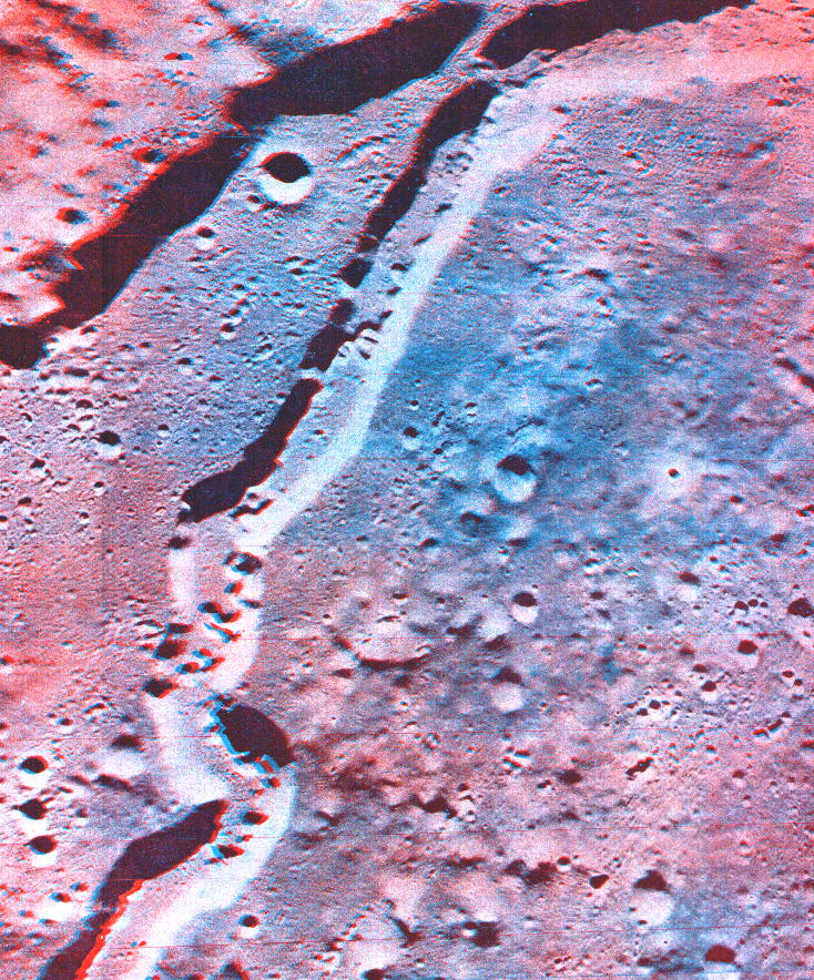
VALLEY Section 18 - Aristarchus lo5m202
SCHROTERS
VALLEY Section 18 - Aristarchus lo5m202
Stereoscopic view of a part of Schroter's Valley, the meandering depression
running from the upper right to the lower left corner of the anaglyph.
This rille is about 7 km wide and up to 1300 m deep. Within its flat floor
is a second, sinuous rille whose tightly packed meandor loops are about
200 m deeper. The ridge that is seen in the upper left portion of the photograph
is about 1600 m higher than the plateau surface into which the valley is
cut.
 RIMA
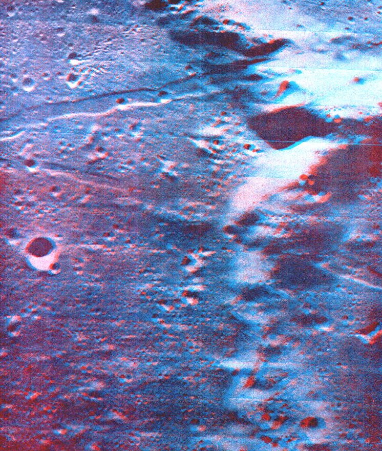
PARRY Section 43, Lalande lo5m139
RIMA
PARRY Section 43, Lalande lo5m139
Stereoscopic view of three adjoining craters; Fra Mauro to the north
(left), Parry (upper right), and Bonpland (lower right). The area where
the three rims meet is about 1200 meters higher than the crater floors.
The two linear rilles form a V whose apex is at the left edge of the photograph.
They dissect the crater floors and rims alike. The more westerly rille
is bordered on the west (near the center of the anaglyph) by a chain of
domes. The adjacent areas of the rille is nearly filled with dark, smooth
material that appears to have come from the domes.
 ARISTARCHUS
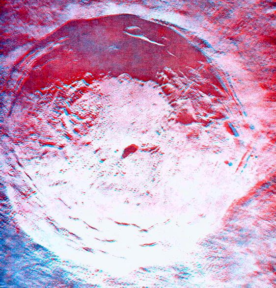
Section 18, Aristarchus lo5m197 Higher resolution
image
ARISTARCHUS
Section 18, Aristarchus lo5m197 Higher resolution
image
Stereoscopic view of the crater Aristarchus, 40 km across and about
3.6 km deep. The floor is partially covered with material that slumped
down the walls; its eastern portion (toward the top of the page), being
least covered by this material, is the lowest and smoothest part. A long
narrow central peak rises 300 meters above the floor. Note the terracing
of the inner crater walls and also the elevation of the rim crest above
the outer ejecta blanket.