 "Where the heck is this again?"
Grand Canyon
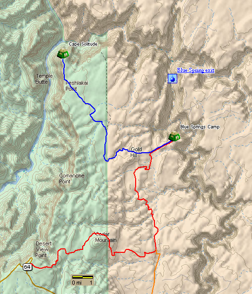
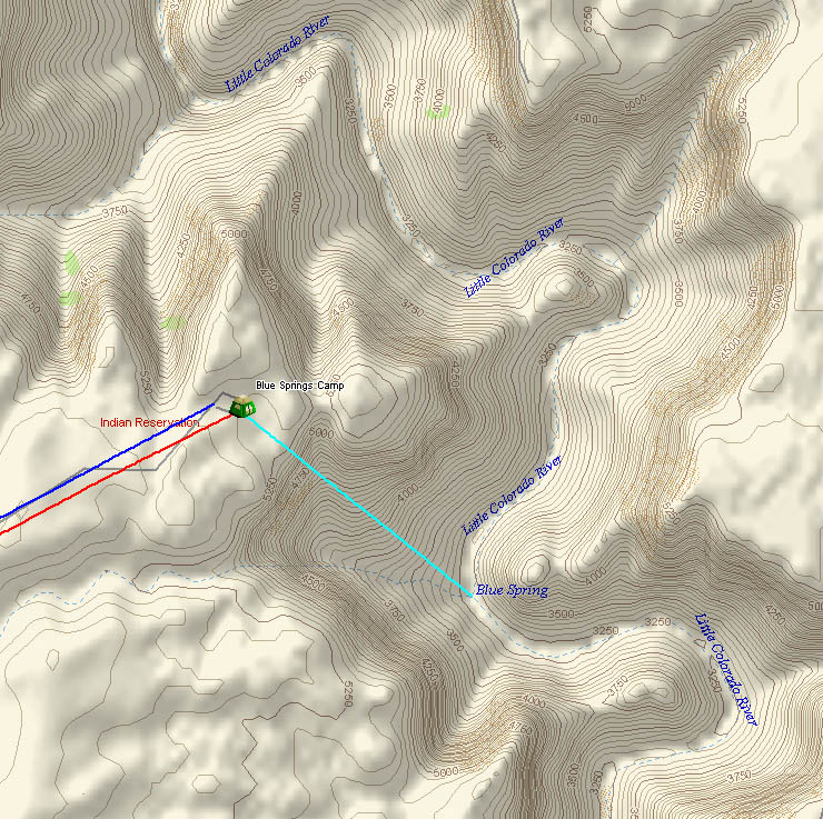
Blue Springs Route Detail
"Where the heck is this again?"
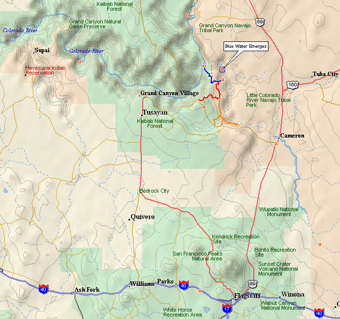
Unfortunately, none of this shows up very well on the map. The Little Colorado snakes off at a right angle to the Colorado river, then does another 90 degree turn south. The map shows another river heading north, but it really is just a trickle.
The topo map below give the best view of it.
Mid-quality Scan of Topo Map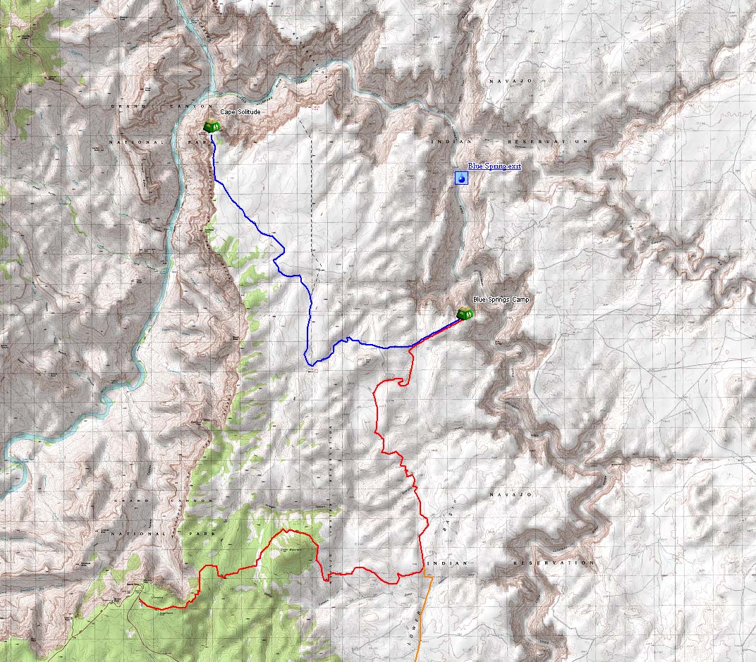 (300k) Gives good general idea. So does the thumbnail. Both Desert View and Blue Springs are there.
Desert View: The approximate start. Find Kaibab National Forest on the bottom of the map. Look a little north of the word "National."
Blue Springs: In the long, skinny North-South Canyon it says "Little Colorado River Gorge." Look between the words "Colorado" and "River."
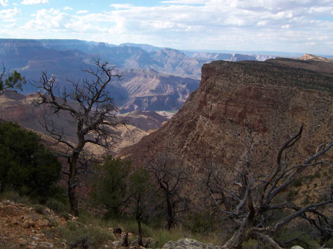
The Little Grand Canyon has the same type canyons, just less people. Millions less people.
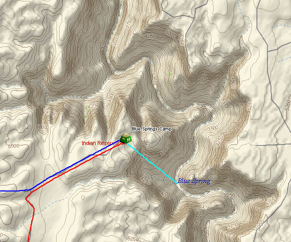
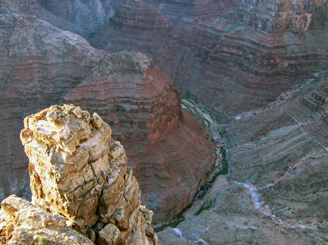
Blue Spring is located at the bottom of the Little Grand Canyon. The site where the Hopi Indians come into this world from the previous one (the Sipapu) is reported to be near it. See the linked Google picture, below.
The start point near the east entrance to the park, just east of the popular popular overlook, Desert View. We'll probably go in via the Indian lands to save the park fees since we won't be in the park. Finding a way in without paying the park fee just to enter the park, then to exit again, has led to several trips up there just to check out the roads.
2004 trip: Made it in via the national park entrance, but no GPS and didn't find the road leading to Cape Solitude
Pictures: http://www.flickr.com/photos/sanaghan/sets/883912/
2005 trip: Had the GPS and the computer map programs, but found electronic maps (including Google) weren't accurate. The roads listed don't exist; some of them go vertical up and down canyon walls. This led to Zena walking ahead with a lantern to scout the road that ran down the edge of the canyon, and not looking happy. I was in the car with the two kids (Tatyanna and Catherine). We made it to a flat spot, but we were stuck and had to camp for the night on Indian land.. We turned around in the morning and drove out.
2006 trip: Used Google earth aerial photo imagery to trace my own roads, export them out. Drove it, found many problems and mistakes, but marked them all up in DeLorme maps. From Google Satellite Maps, which has more detailed maps of national parks and other high interest areas, here's some points from the trip:
I believe this is the Hopi Sipapu 36.1923,-111.7346. It looks more like a mound than an emergence.
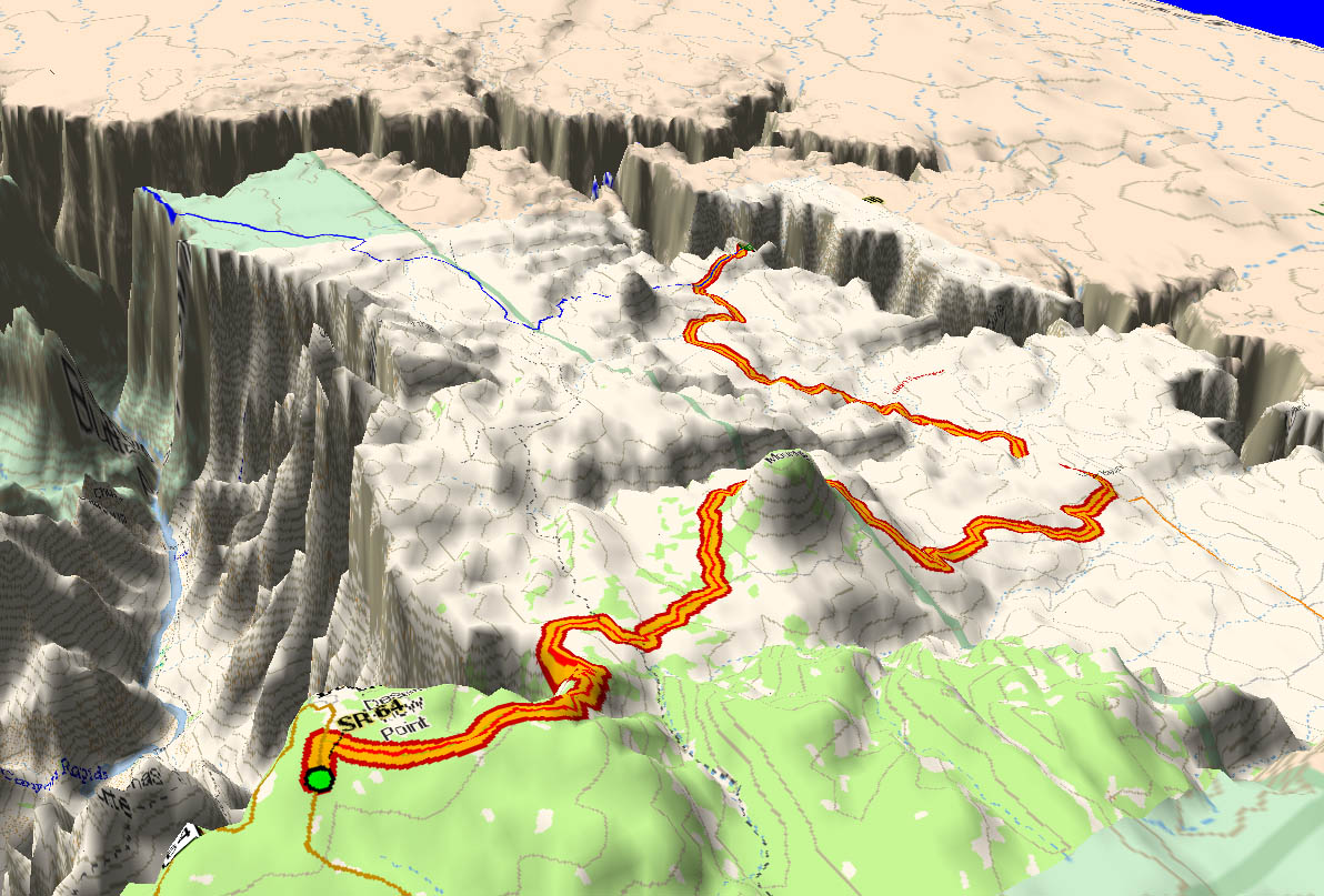
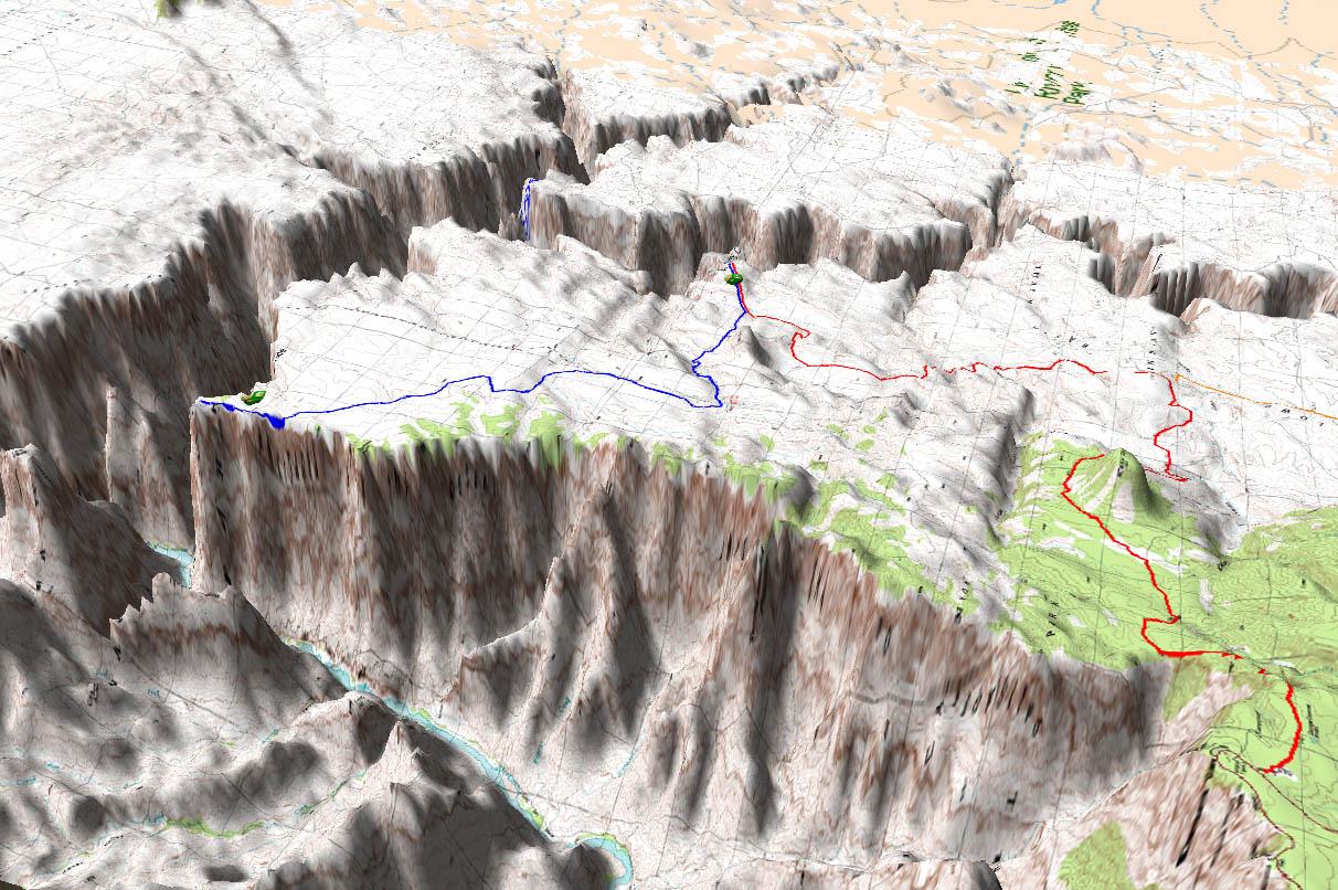
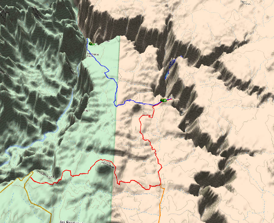
These 3-D pictures show the Ranger Station route pretty well. (About 200k each). Left looks to the North East from near Desert View, right looks to the North West from the middle of the desert. The last picture shows the trip from the Ranger Station to camp from both a top and relief view. The road on the map is incorrect; the road actually continues to the canyon edge (the red line I drew). This is actually the easy part. We can walk, bike, or drive it (in the right vehicle). Otherwise, we can come in off of 64 and 4x4 our way in.
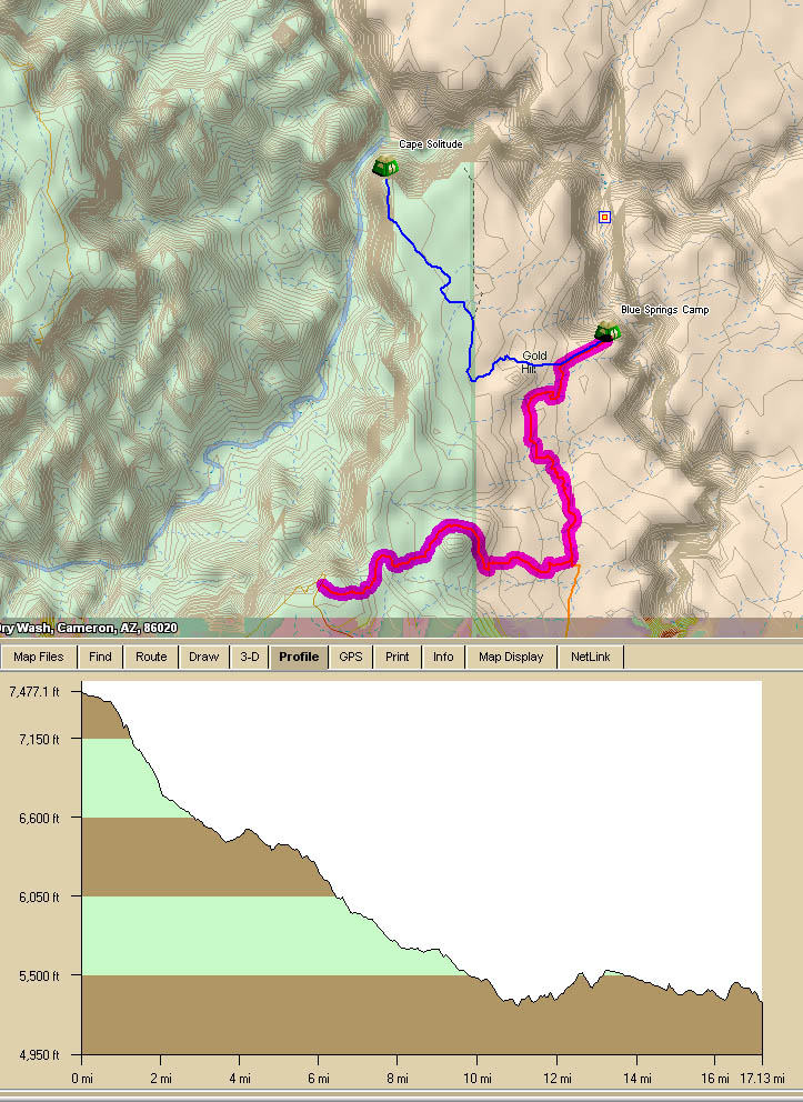
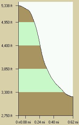
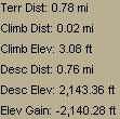
Camp To Blue Spring
The last part of the trip is the descent itself. We'll keep switching back and forth around the area formed by the red-blue "V" below.
Here's some pictures and stats on the descent. Open your browser wide enough and they go side-by-side. In the pictures on the right, just south of Scary Pass you can see how the wall curves back in again. That's where Zena and I hit the infamous "W" problem we had to get around (see the trip reports).
 Final Thoughts
I know I keep stressing that overall this is a dangerous hike, but it's really not as bad as it seems. Like I said on the main page, there is no single event that will hurt you. It's just this is a real "natural state," unstable trail with no support like we have even on mountains like Orizaba where there's 20 people climbing, plus professional guides, on any given day. The consequences are magnified if there's an accident. Ex: Going off belay, put your hand down, touch a "Mule Kicker" (velvet ant), the intense pain causes you to lose your balance....
In most spots on this hike, if you fall you just fall, curse a little bit, and get back up. But there are a lot of others where if you fall, you're going to bounce for a while until you stop, and everyone else will be cursing because we'll have to carry your body up 2000 feet and, if we took the vehicle option, we'll have to drive two hours to the ranger station. If we didn't take the vehicle option, it's a long, uphill fireman carry. (We are each responsible for supplying our own Jacek to carry us out in the event of an emergency.)
We could call the Indians, but honestly they don't care if you die, as long as you have your permit. (...to hike there. The permit to die there is an extra $50, plus any expenses incurred in getting your body out, payable by your estate. This is for all the new age boomers out there.....joke, people.) Here's a Desert Hiking Tip: You know, a person gets lighter as the vultures pick at you and the desert air dries you out.....
The way in, descending from the Ranger station.
The trail head is a thin line, descending from the upper left. I'm the white spec in the middle; you have to climb down and around the tree and keep working your way down.
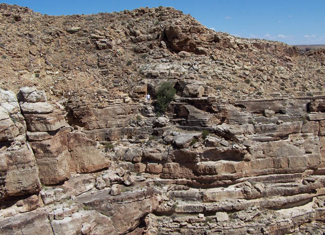
There are no visible trails. The slide coming down from the upper right down to the river is where the Blue Spring point is on the map.
![]() Map images from Topo 5 © 2006 DeLorme Topo USA®
Map images from Topo 5 © 2006 DeLorme Topo USA®