 Robert
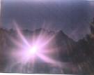
Santee took this photograph of a square 'cave' on a sheer cliff on the
side of Mt. Shasta. There was no apparent light visible at the time. This
strange pattern of light eminating from the hole is visible in the photograph
only. The light may be outside the normal range of human sight, possibly
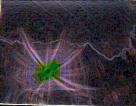
UV. The 'arms' appear to radiate out and upward. The image on the right
has been processed to show the source of the light in more detail.
Here is Bob's letter describing this strange image:
Hello Steve, This attached picture was taken almost two years ago down in northern California. The roll of film sat around the house and I finally got the prints done yesterday. When I looked at this picture, among the rest, I went into immediate mental alert. The why of that alert follows.
My girlfriend and I were down in an area somewhat south of the Mount Shasta Area. We took a back road and while moved around a large butte of rocks and went on the back road for several miles. When we returned, we were looking more directly at the butte and my girlfriend noticed a square hole about half way up the side of the butte. The rock went straight up from ground to the top, and the square hole in the rock was halfway up, and inaccessable except by rope and climbing gear from the top. The hole appeared as a dark image on a contrasting white cliff. You could not see into the shaft ( which it appeared to be), because we were below it, looking somewhat upward and were about 1/4 mile away from the hole in straight line distance. We stopped the car and got out and started looking at it. It was facinating. We talked abouit what we thought it might be. I thought it might be a ventilation shaft for something inside the cliff, although I couldn't imagine what with any accuracy. Guess it could have been a lot of things. We then went back home to Oregon, and occasionally talked about that square hole. Now, some 2 years later, I finally got the picture back and see the bright center spot and rays coming out, rays which bend slightly in a left hand curving sweep. As some of the rays seem to come into contact with the mountainous outcroppings, the rays seem to cast a reflection on them. Please understand that none of the rays or center light is visible by the human eye. The square was dark when we viewed it, and took the photograph of it. Only upon obtaining the print, could we then see the effect that must have been imprinted on the film. I am unable to solve this mystery photo alone.
I would like some opinions (hopefully responsible) on what it might possibly represent. If you blow up the image, I begin to see some shaded areas on the photo. The only guess I could make about this is shading, is that the rays (since they affected the film which was physically 1/4+ miles away), may have somehow bounced back onto the bellows, then bounced back again onto the film. If you have any suggestions on how I could proceed to find out more about this, I would appreciate hearing those suggestions.
Robert Santee
John Winston comments about this unusual image:
JW: Yes I have heard about things like this before. On the geological survey photoes of the area it shows a white light coming from Mt. Shasta. There are also areas where the people inside of the Mt. let excess energy come out into the sky. It is a bi-product of there energy production system. I hope this helps answer you question.
A Crop Circle formed one summer night in 1995 near Santa Rosa, CA. I helped co-create it after a meditation session a few months before where I felt a telepathic connection with benevolent ETs I felt at the time were Pleiadeans. I drew up the design at this time and was surprised to see it appeared on a hillside in nearby Sonoma county, which has many underground caves.
This crop circle marks the location of an underground Reptilian/Grey base, IMO.
Near this location is a Masonic Temple with No Tresspassing signs posted all around the perimeter.
Very strange 'vibes' in this location... been there. Very draining of
the life force.
 Santa
Rosa Crop Circle
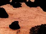 Santa
Rosa Crop Circle, larger version showing hillside
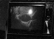 This
image of a possible alien was captured on film. Here is a
larger version. This is the letter I received
with more details.
 Map
of U.S Government Underground Facilities and Structures
 Map
of earthquakes near Ridgecrest, CA, 1980-1995. Ridgecrest is a few
miles north of the the Naval Weapons Research
Area. Very interesting...
![]()
![]()
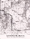 Map
of Groom Lake area showing Restricted Area. Until recently, the U.S.
Government refused to acknowledge the existance of this secret base, which
is supposedly partially underground.
 Map
of Groom Lake facility
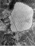 Russian
satellite image of the Groom Lake area
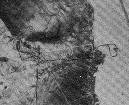 Detail
of satellite photo reportedly showing the location of a Grey underground
base
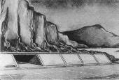 Artist's
conception of enterances to the underground facilities at Groom Lake
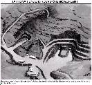 Libya's
underground base is probably an underground chemical and/or biological
weapons production facility. "Excalibur Weapon"?
 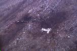 Ron
Brown's plane crash is full of anomalies. Is Ron Brown, who was to
testify and was ready to 'tell all', another in a long list of strange
deaths possibly related to Bill Clinton? This is an image of the crash
site, from the Department of Defense.
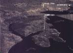 This
is a computer-generated image of Ron Brown's plane crash site, from
the Department of Defense.
 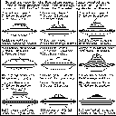 Drawings
of Several Types of Beamships
 The
Ether, #1
  The
Ether, #2
  The
Ether, #3
  The
Ether, #4
 Jupiter's
infrared emissions are concentrated at approximately 19.5 degrees north
and south of the equator. The giant Red Spot, a huge storm lasting hundreds
of years, is also located in this zone. Many planets exhibit energetic
phenomina at these latitudes, such as storms, volcanos, and other events,
which are directly related to tetrahedral hyperdimensional physics.
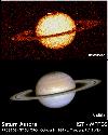 Saturn's
ultraviolet emissions show a bright energetic area near both poles.
Is this an aurora, or the light from an inner sun within the hollow planet?
 Anomalous
pattern at the North pole of Saturn shows the inwelling of the hyperdimensional
energy flow into the planet.
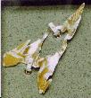 This
piece of metal is allegedly from the Roswell UFO crash in 1947.
 HARRP
Spectral Graph #1
  HAARP
Spectral Graph #2
 HAARP
Timeline -- Prototype testing is finished according to published schedule.
What's next? Higher-power operation, with even more power planned for the
future.
 Comparison
of power levels for HAARP at various phases of completion with other
facilities.
 The
Reptoids are Hungry
If you have any comments about this page please contact: