Map of North America 1845
![]()
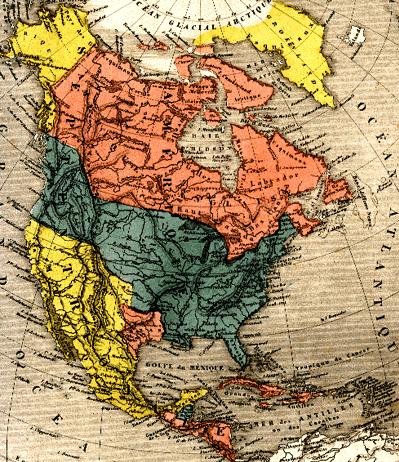
This 1845 French map shows an independent Texas and the southwest still as Mexican property. It is from the Atlas Universel Illustré. The map is titled Amérique Septentrionale. The map measures about 7 x 8 inches, while the printed area is about 17 x 11 inches. Printed outside the actual map but within the borders are various American animals.
This map stolen from the Tennessee Gen Web Project.
![]()
Original 1/7/98
Last updated 4/14/2007
Page by F. Preston